Nauvoo: A Temporary Refuge
Museum Treasures
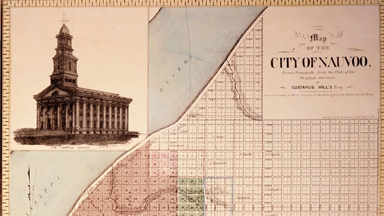
This map of Nauvoo was first printed in 1842 by Gustavus Hills, a recently converted member of the Church, and it illustrates the Saints’ optimistic expectations for their city. Members of the Church thought they had finally found a permanent home in Illinois. This is where they would build Zion.
Beginning in 1839, Church members who had been forced from their homes in Missouri crossed the Mississippi River into Illinois. They had suffered much, and many Saints found themselves destitute.1
As they crossed into Quincy, Illinois, Church members found that the local residents were sympathetic and welcoming.2 Church leaders bought land in Illinois and Iowa, establishing settlements throughout the area.3 The city of Nauvoo was the largest settlement and the headquarters of the Church.4
In 1840 the Illinois legislature approved the Nauvoo charter, giving the Saints greater legal protection than they had ever known.5 Members of the Church thought they had finally found a permanent home in Illinois. This is where they would build Zion.6
This map was first printed in 1842 by Gustavus Hills, a recently converted member of the Church, and it illustrates the Saints’ optimistic expectations for their city. Prints of the map were sold to Nauvoo residents in 1844 at Brigham Young’s home.
The map itself is a plat of the city, showing actual and planned features of the town, such as streets and parcels of land.7 City planners anticipated a large population. In 1841 Joseph Smith invited all Church members living elsewhere to gather in Nauvoo: “Let the brethren who love the prosperity of Zion, who are anxious that her stakes should be strengthened, and her cords lengthened, and who prefer her prosperity to their chief joy, come, and cast in their lots with us, and cheerfully engage in a work so glorious and sublime, and say with Nehemiah, ‘we, his servants will arise and build.’”8 At its peak, the population of Nauvoo was about 15,000,9 rivaling Chicago in size.10 Only about 60 percent of the planned area, however, was ever subdivided for members to settle within Nauvoo’s city limits.
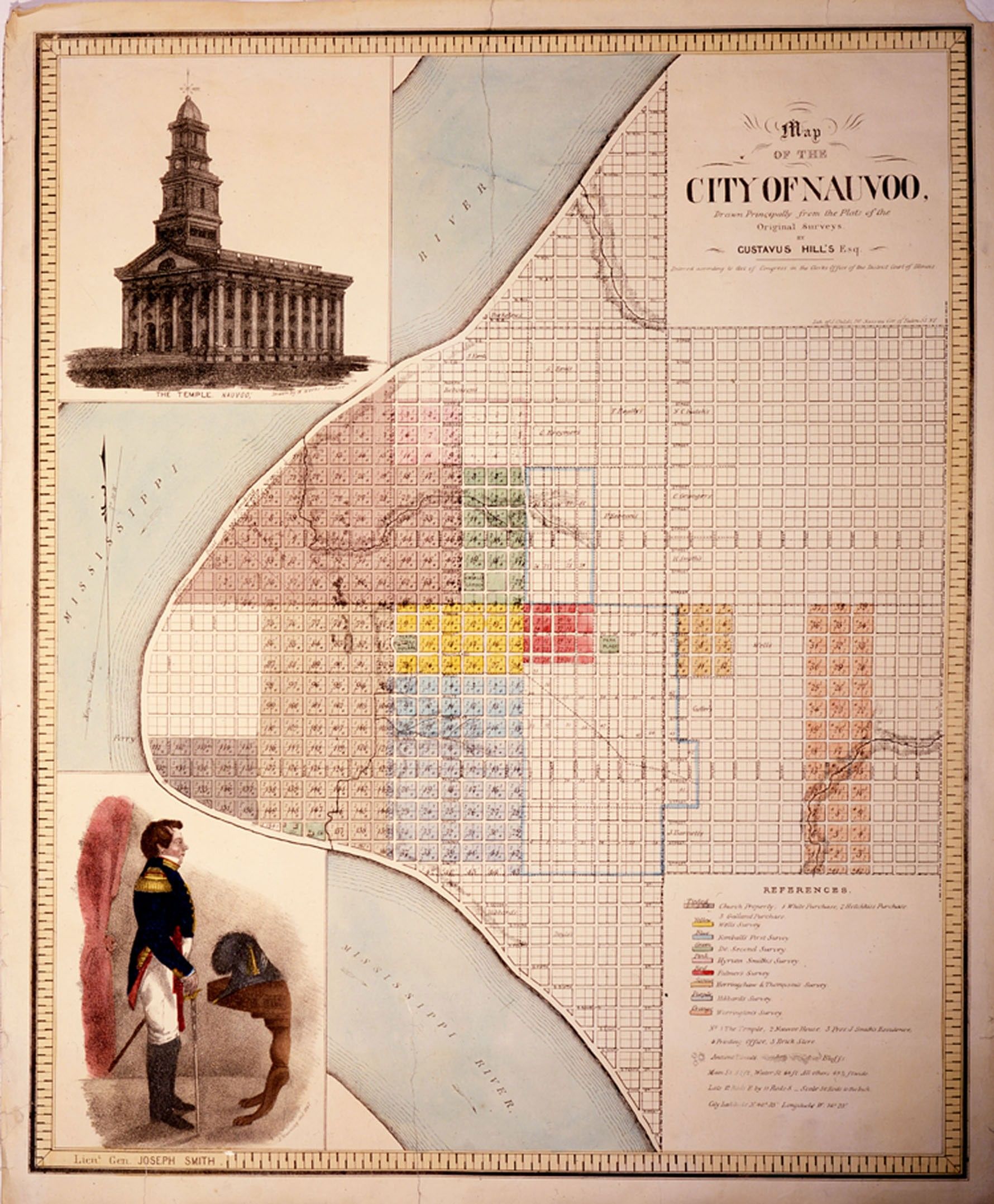
Sutcliffe Maudsley’s drawing of Joseph Smith in the lower left corner of the map shows him in his uniform as lieutenant general of the Nauvoo Legion.11 The ability to form a local militia was important to the Saints, considering that they had not been able to rely on state or federal troops to protect them from past violence.12
In Nauvoo, Joseph Smith received and taught new doctrine, especially related to the temple.13 In the top left corner of the map is architect William Weeks’s early design of the Nauvoo Temple, which was a central focus of religious life in Nauvoo.14 Construction on the Nauvoo Temple began in 1841 but was not completed until after Joseph Smith’s death. The Saints donated their time, funds, and materials to build the temple, and they eagerly awaited temple blessings.15
For several years, residents of Nauvoo enjoyed a boom of industry, education, social activity, and spiritual edification.16 This period of prosperity, however, did not last. Conflicts again arose from within and without the Church, leading to dissension, violence, and the death of Joseph Smith.17 In 1846, only seven years after the Saints first arrived in Illinois, the first wagons rolled out of Nauvoo toward a new home in the West.
However briefly the Saints lived there, Nauvoo will always be remembered as a place and a time of prosperity, optimism, and faith.