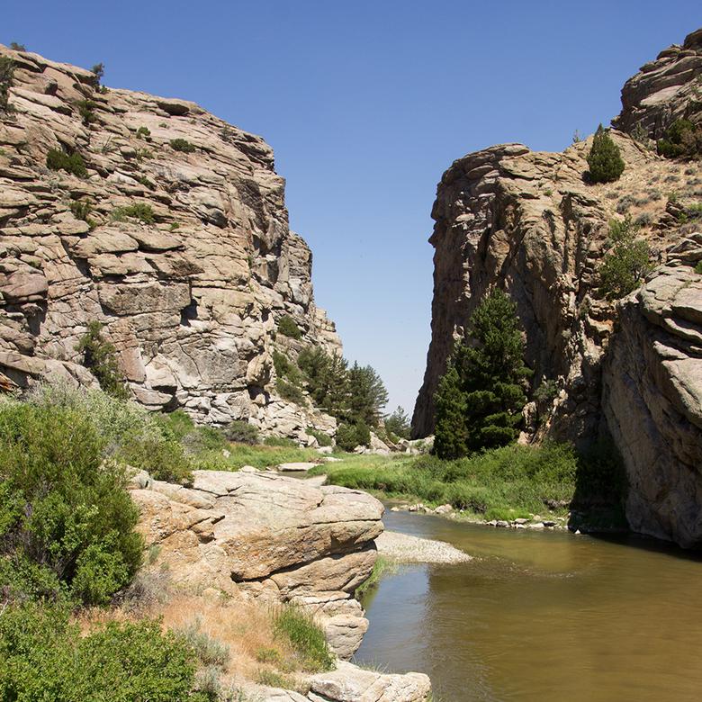
Sketching the Sweetwater Valley
About 450,000 people traveled the California, Oregon, and Mormon Trails between 1841 and 1868. Though they came from many places, went to different destinations, and traveled for different reasons, most passed through the Sweetwater Valley in modern-day Wyoming. Walking or riding through the 100-mile valley, with its meandering river and unique geological formations, became a shared pioneer experience. Motivations for documenting this shared space differed, but the same landscape features of the valley found their way into many journals, letters, and sketchbooks.
As travelers passed topographical curiosities along the trail west, they often noted them in word and in art. Drawing features of the landscape in journals, letters home, or in other written records was a common practice along the trail.
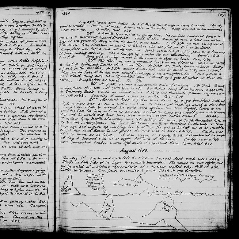
Mormon pioneer Luke W. Gallup sketched the bluffs surrounding Chimney Rock in his journal on August 1, 1850. 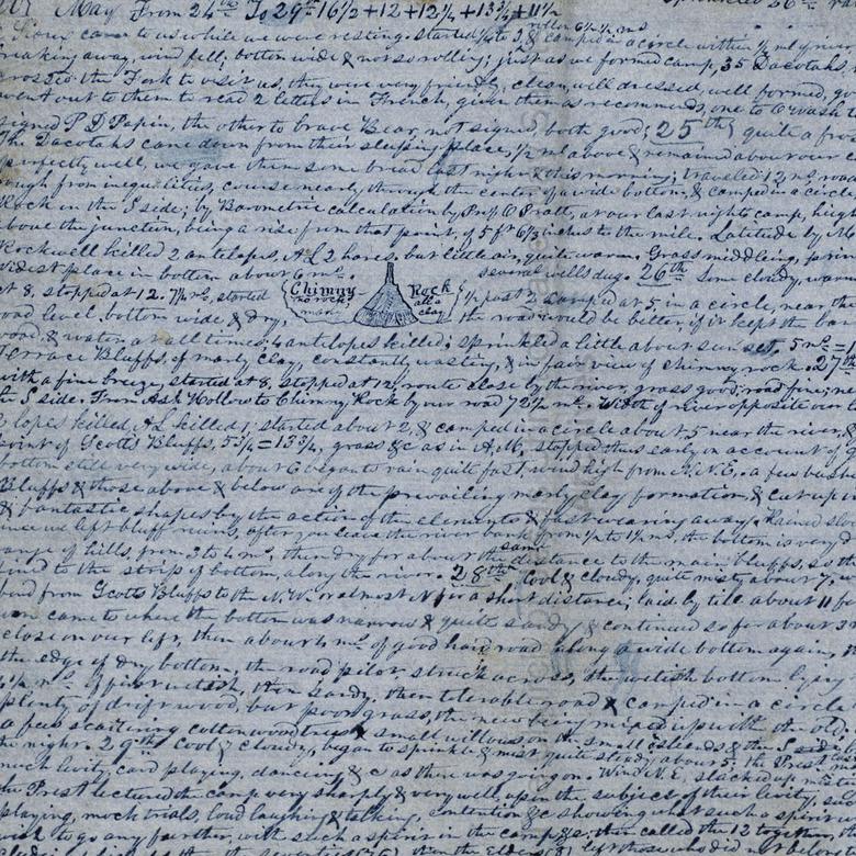
Some emigrants sketched the unique geological formations along the trail in journals and other records. 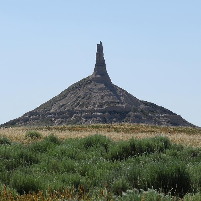
Chimney Rock is a national historic landmark.
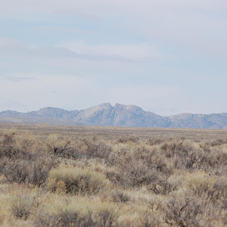
The westward journey through the Sweetwater Valley usually lasted about a week. Landmarks along the trail gave travelers new opportunities to describe their progress.
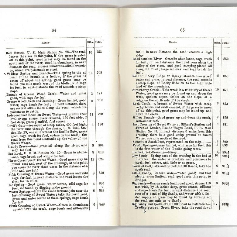
Guidebooks identified the geological features of the Sweetwater Valley. 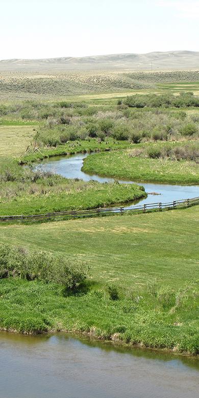
Parties crossed the Sweetwater River nine times during their passage through the Sweetwater Valley.
“The river, at this place, is bordered by hills of the valley formation. They are of moderate height; one of the highest peaks on the right bank being, according to the barometer, one hundred and eighty feet above the river.”
—John C. Frémont, August 5, 1842 
John C. Frémont noted geological features of the Sweetwater Valley in 1842. 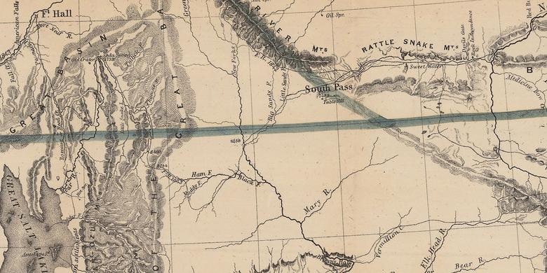
This map of Oregon and Upper California was created by Charles Preuss from the surveys of John C. Frémont.
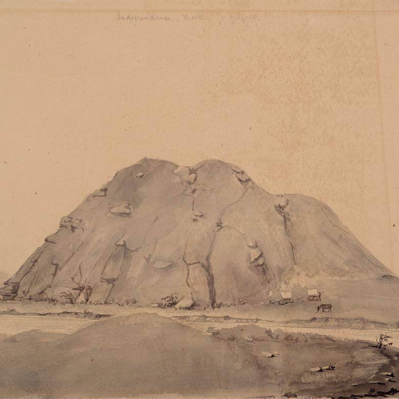
Independence Rock
For those traveling west to California and Oregon, reaching Independence Rock by about July 4—the United States of America’s Independence Day—meant that they would likely arrive at their destinations ahead of winter snows. Thousands of people carved or painted their names onto the giant granite boulder’s smooth surface before moving on. Others commemorated the milestone by sketching the rock.
“Many a name famous in the history of this country, and some well known to science, are to be found mixed among those of the traders and of travellers for pleasure and curiosity.”
—John C. Frémont, August 1,1842 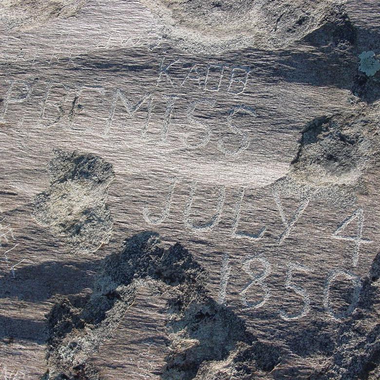
Many emigrants paused to leave their mark on Independence Rock. Some of these marks are still visible today. 
William Clayton, traveling with the Mormon vanguard company, arrived at Independence Rock on June 21, 1847. 
William Clayton paused to draw the circumference of Independence Rock in Heber C. Kimball’s journal on June 21, 1847.
Military expeditions moving west often included a company artist to document the landscape. Many military artists sketched features of the landscape in the Sweetwater Valley, starting with Independence Rock.
Osborn Cross led a military expedition of mounted riflemen through the Sweetwater Valley in the summer of 1849. 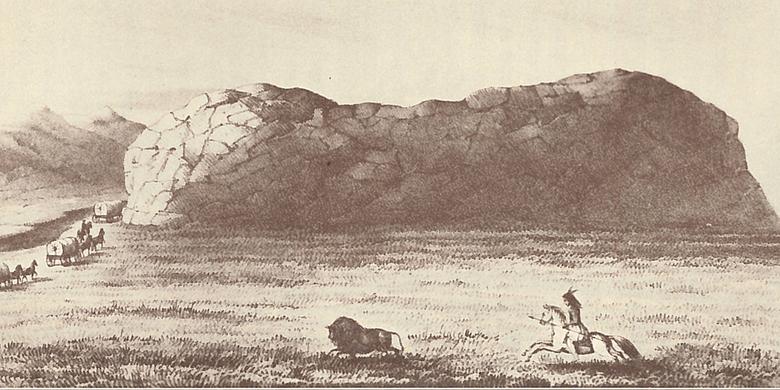
Two artists accompanied Cross’s expedition. They sketched dozens of scenes on the trail, including Independence Rock.
Several artists traveled the overland trail to capture the American West for the benefit of audiences in the East.
Artist James F. Wilkins traveled west to create a “Moving Mirror of the Overland Trail.” 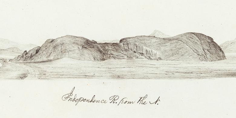
Artist William Quesenbury sketched “scenery, curiosities, and stupendous rocks” for orator and entrepreneur John Wesley Jones.
Artist Frederick Piercy, a British convert to the Church, created this etching of Independence Rock. “My object was to make sketches of the principal and most interesting places on the Route, . . . which were afterwards to be published with suitable descriptions and statistics.”
—Frederick Piercy, February 5, 1853 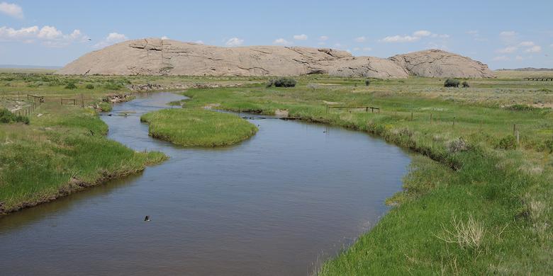
Today, Independence Rock is recognized as a national historic landmark.
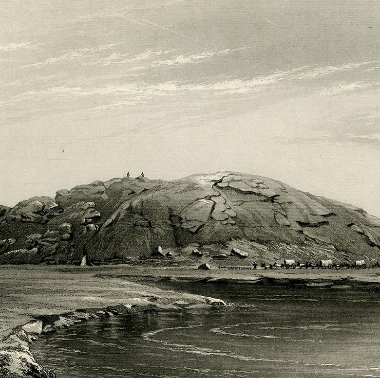
Devil’s Gate
Cut into the granite mountains by the Sweetwater River, Devil’s Gate caught the attention of those passing through the valley. The almost 400-foot-tall cliff walls and 30-foot-wide chasm inspired many emigrants to sketch the topography through which they passed.
“President [Brigham] Young, [Heber C.] Kimball and others went to view the north side of Devil’s Gate and returning reported that the Devils would not let them pass.”
—William Clayton, July 21, 1847
Adventurer and amateur artist Joseph Goldsborough Bruff sketched many scenes from the Sweetwater Valley. “Some of the boys clambered up the rocks on the N side of the Gate, . . . and threw down rocks, pleased with the reverberation, which was great. I made a careful sketch of this remarkable gorge.”
—Joseph Goldsborough Bruff, July 26, 1849 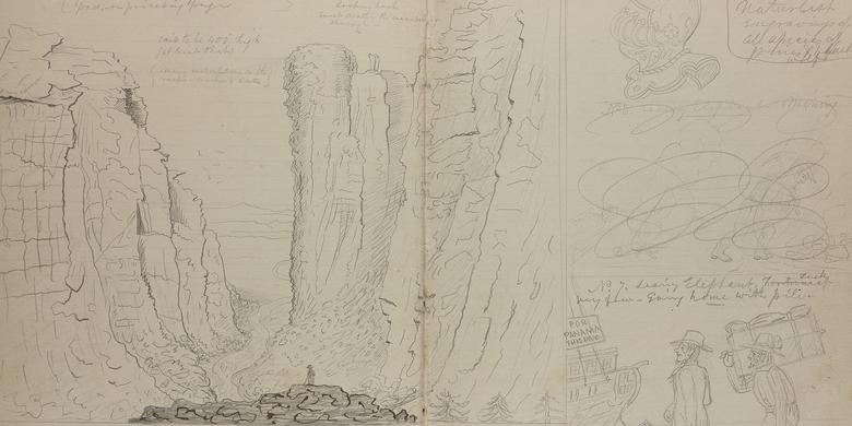
Captain Joseph Goldsbrough Bruff’s sketched Devil’s Gate on July 26, 1849.
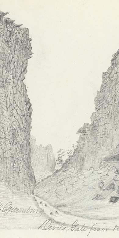
William Quesenbury sketched Devil’s Gate in 1851. 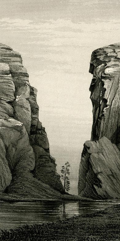
Artist Frederick Piercy, a British convert to the Church, created this etching of Devil’s Gate.
“We shall pass successively the Devil’s Gate, the Devil’s Post-office, and the Devil’s Hole,—in fact, we shall not be thoroughly rid of his Satanic Majesty’s appurtenances till Monte Diablo, the highest of the Californian coast-range.”
—Richard F. Burton, August 17, 1860 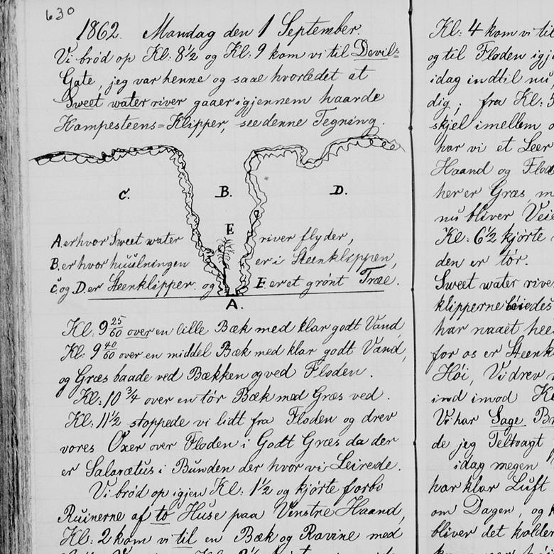
Jens C. A. Weibye sketched this silhouette of Devil’s Gate on September 1, 1862. 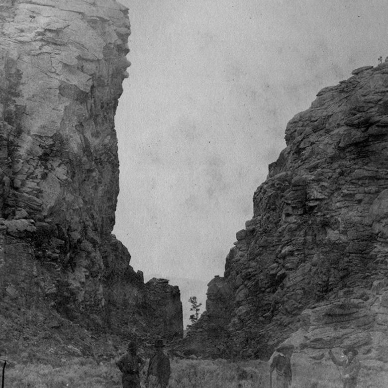
This early photograph of Devil’s Gate was taken by Samuel C. Mills on August 17, 1858.
Split Rock and South Pass
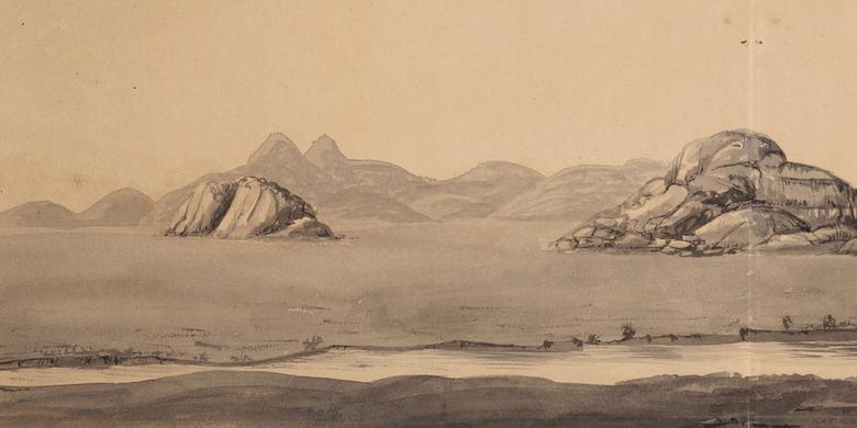
At the end of their travels through the Sweetwater Valley, travelers passed Split Rock and moved through South Pass. For several days, Split Rock, a noticeable gap in the distant Rattlesnake Mountains, would have been visible to those on the trail. Those sketching the mountain range often included the unique formation. Crossing the continental divide at South Pass was an important milestone of the trail, but because the pass was such a gentle climb, most travelers were unaware of the actual crossing.
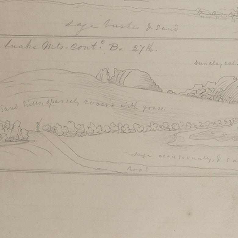
Captain Joseph Goldsbrough Bruff sketched the Rattlesnake Mountains, including Split Rock, on July 27, 1849.
In his rendering of the Rattlesnake Mountains, artist James F. Wilkins captured the silhouette of Split Rock. 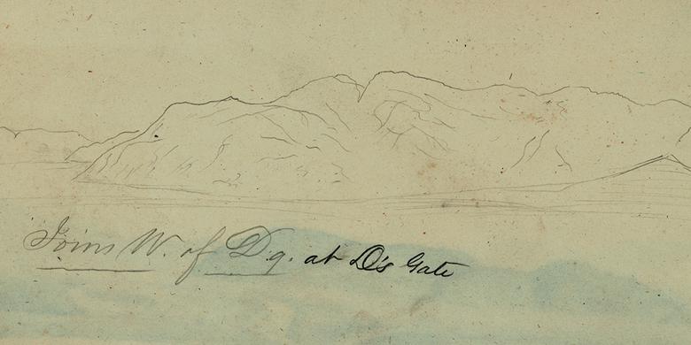
William Quesenbury’s sketch of the Rattlesnake Mountains in 1851 included Split Rock.
“Came thro’ the south Pass yesterday, without scarcely being sensible of any change.”
—James F. Wilkins, July 18, 1849 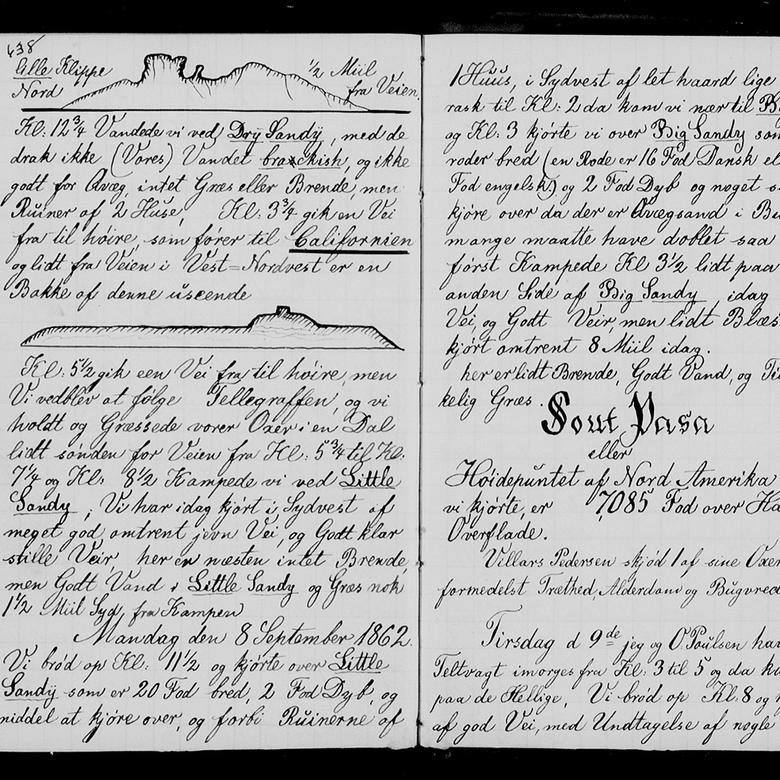
In September 1862, Jens C. A. Weibye commemorated his travel through South Pass with ornate writing. 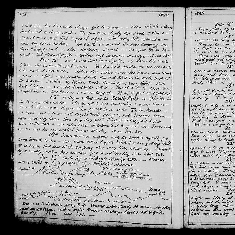
Mormon pioneer Luke W. Gallup sketched South Pass and the surrounding mountain ranges in his journal on September 15, 1850. 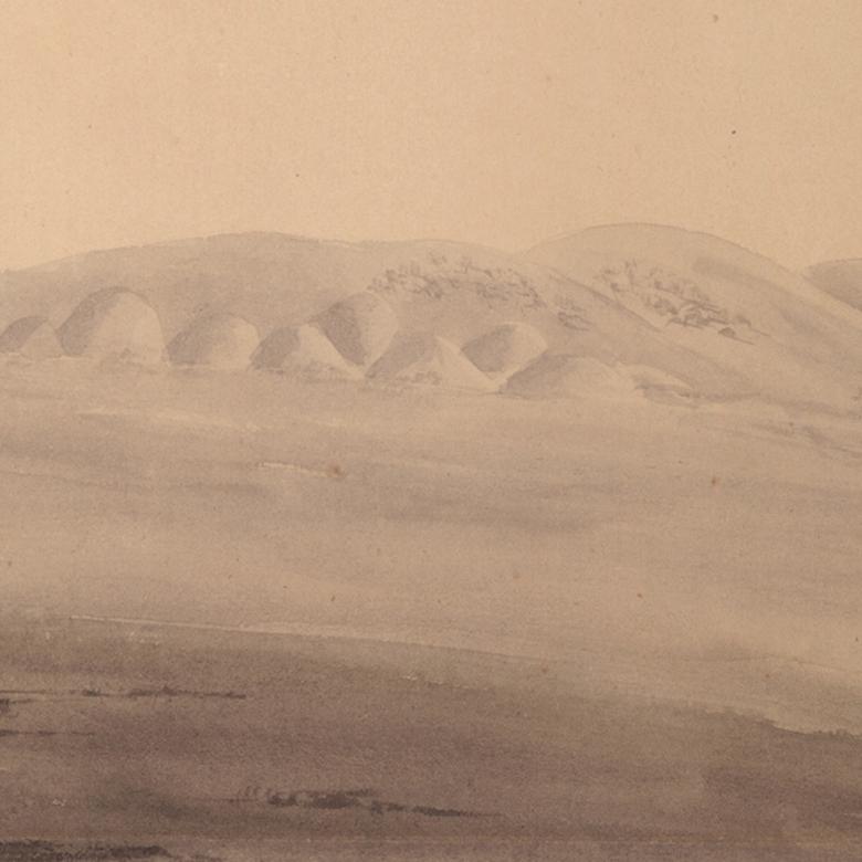
James F. Wilkins sketched South Pass on July 18, 1849.
Further Reading
Mormon Handcart Historic Site: Martin’s Cove
Sun Ranch at Devil’s Gate exhibit
National Parks Service: Independence Rock
National Parks Service: Devil’s Gate
John Francis McDermott, ed., An Artist on the Overland Trail: The 1849 Diary and Sketches of James F. Wilkins (San Marino, California: Huntington Library, 1968)
Georgia Willis Read and Ruth Gaines, Gold Rush: The Journals, Drawings, and other Papers of J. Goldsborough Bruff (New York: Columbia University Press, 1944)
David Royce Murphy, Scenery, Curiosities, and Stupendous Rocks: William Quesenbury’s Overland Sketches, 1850-1851 (Norman: University of Oklahoma Press, 2011)